| Pinedale
OFFline |
|
|||
Wyoming pioneers windmill blade recycling for massive energy production
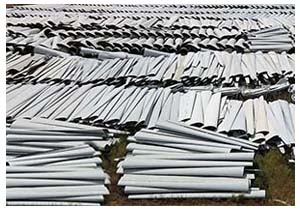
As with most everything, these windmill structures have a life span, and with time, pieces and parts eventually wear out or break, needing to be discarded. Growing graveyards of windmill parts have started to accumulate and people have scratched their heads with what to do about these massive relics of equipment. Wind turbine blades can range from 170 to 350 feet long. Moving these large objects takes heavy equipment, logistical coordination, and vast storage and disposal planning. One solution for what to do with the discarded windmill blades has been to bury them in large pits. But where does one find pits large enough for these huge blades to fit in? An idea being considered is to put these decommissioned blades and discarded parts as backfill in closed, surface pit coal mines in Wyoming. Some environmentalists don't like the idea of pristine Wyoming land being used as the dumping ground for green energy trash. With the new administration under President Trump, and his call to rebuild the oil and gas industry and "Drill Baby Drill!," a new project is underway to blend recycling with green wind energy to bolster clean natural gas energy production.
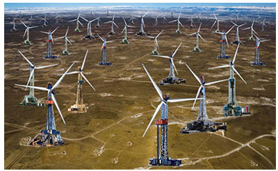
Several natural gas companies have already begun outfitting their drill rigs with wind turbines to power their drilling operations. Companies are already seeing a large return on their investment in efforts to find novel ways to use 'good' green wind energy to help extract the much-needed natural gas to fuel the world's growing demand for clean energy. The public is very used to seeing vast windmill farms along the skyline across Wyoming, and these modified hybrid windmill/gas drill rig farms will be very visually compatible with what is already happening on the landscape across the state. Wyoming has once again become ground zero as the test case for implementing new environmentally-friendly technology in energy production. More innovative recycling
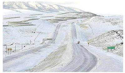
Snow fences help block wind-blown snow from building up along the interstate, which causes travel to become difficult. The large wide windmill blades do a great job of slowing down the wind energy, causing the snow to drop to the ground next to the snow fence instead of getting blown across the travel lanes of the highway. The existing wooden snow fences provide a strong structural frame on which to attach the long wind turbine blades. "They are pretty easy to install," said WYDOT Engineer Frank Garcia. The public can look forward to seeing more of these windmill blade snow fences as they travel the scenic major highways across Wyoming. "We're all pretty proud of our efforts to incorporate green energy products into our winter highway safety efforts," Garcia said. He added that the white color of the windmill blades will blend in nicely with the winter landscape. Enhancing international border security
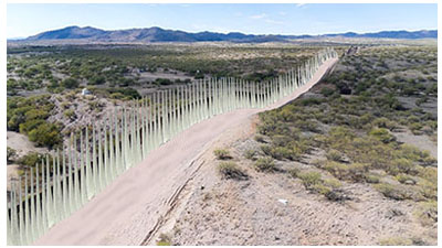
The blades are all of consistent shape and size, making for a uniform visual look and ease of installation. Some observers have remarked the wall now looks like a decorative giant white picket fence. Wyoming is proud to be contributing to the country's border security while at the same time doing our part in recycling what we use. |
|||
| APRIL FOOLS! | |||
Disclaimer: Pinedale OFFline is an April Fool's Day edition of Pinedale Online. All stories and persons quoted here are fictitious and photos shamelessly digitally altered for this special edition. No real persons or entities mentioned on this website can be held responsible for claims made in Pinedale OFFline stories. |
|||
ww.PinedaleOFFline.com


